


2022 Tracking
Southern Right Whales

As part of our Darwin Plus funded project (DPLUS126), we are aiming to deploy up to 10 satellite tags on southern right whales during the winters of 2022 and 2023. Our research questions for southern right whales mean that we will use two different types of tags:
(1) Five SPLASH tags will collect both location and dive data, and are intended to provide fine-scale information on habitat use and behaviour while the whales are around the Falklands
(2) Five SPOT tags will collect location data only, which will extend their battery life over many months with the aim of better understanding the wider-scale movements of the whales and the links between the Falklands and other geographic regions
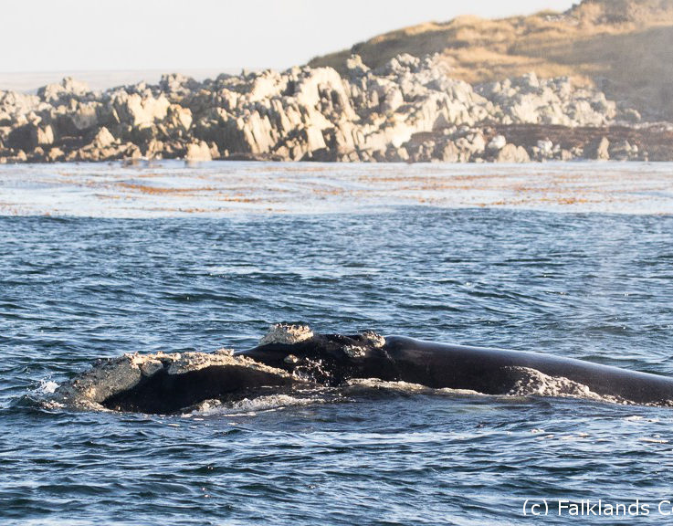
All 10 tags are being deployed in July 2022. In the two maps below, the tracks of each whale appear as different colours. Tags that are still actively transmitting will have a flashing circle beside their number. The locations vary in their accuracy, and some are only correct to within several kilometres; since right whales often occur close to the coast in the Falklands, this means that some locations may appear on land!
Map 1: The tracks of five whales tagged with the SPLASH location + depth tags, with expected lifespan of approximately three months.
Map 2: The tracks of whales tagged with SPOT location-only tags, with expected lifespan of up to nine months.
To ensure high standards of animal welfare, the southern right whale tagging will occur in collaboration with Alex Zerbini of Instituto Aqualie (Brazil), who has developed some of the international best practice standards for whale tagging. Jennifer Jackson of the British Antarctic Survey (UK) has provided five of the right whale tags, with the other five tags being funded by Darwin Plus (DPLUS126). The work is carried out with a Falkland Islands Government research permit (No. R14.2020).