


Tracking
Sei Whales

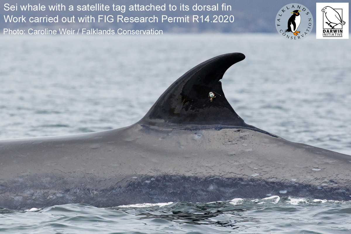
As part of our Darwin Plus funded project (DPLUS126), we plan to deploy up to 10 satellite tags on sei whales over the summer and autumn of 2022 to 2024. The tags will be attached to the dorsal fins of the whales, and will be programmed to transmit GPS positions and satellite fixes, and to send detailed data on their dive behaviour.
Through this work, we’re aiming to understand more about the spatial movements of sei whales, how they are using Falklands’ waters to find food (i.e. the water depths that they dive to and spend most time in), their behaviour (e.g. whether their dive patterns and movements vary between day and night), and their exposure to human activities (e.g. ship collision risk).
During 2022 and 2023, six tags were successfully placed on to sei whales, and a map of their tracks can be seen below with the six different whales shown in different colours.
Tags that are still actively transmitting have a flashing circle beside their number. The locations vary in their accuracy, and some are only correct to within several kilometres; since sei whales often occur close to the Falklands coast, this means that some locations may appear on land!
We hope to deploy the remaining tags in 2024, and the tracks from successful tagging attempts will be available in the map below.
Tagging whales requires high levels of expertise and the use of international best practice approaches to ensure high standards of animal welfare. The Falklands sei whale tagging work is being carried out with a research permit from Falkland Islands Government (No. R14.2020), and in collaboration with expert whale tagging personnel comprising Alex Zerbini of Instituto Aqualie (Brazil) and Rui Prieto of the Okeanos Institute, University of the Azores.